
Trace a Cleveland Street Address
Address research in Cleveland is parcel by parcel. Begin at Cuyahoga County MyPlace, select Cleveland where the City control is available, and choose Address, Owner, or Parcel. An address leads to a physical site, while the parcel number preserves the county’s identity for that lot. MyPlace does not document an entire-street resident roster. Its map and selected-parcel view instead provide the disciplined way to examine a street segment without turning a property record into a household list.
- Enter the street number or address in MyPlace and save the selected parcel number, situs address, and transfer lead.
- Use View Map to orient the parcel, then open nearby parcels individually when the question concerns a short street segment.
- Open the Transfers tab or document-list path, then check the dated instrument in the Cuyahoga County Official Records Search.
- Record each grantor, grantee, instrument date, recording date, legal description, and document number before moving backward.
- For an identified person, Ohio Voter Search can confirm registration by first name, last name, and county; it is not an address-only street roster.
The resulting trail identifies recorded property interests and related address evidence. It cannot establish every occupant of a building. A person who needs a named historical household rather than a current parcel trail can use the collections described in the Cleveland city directory.
Cleveland Street MyPlace Search
MyPlace is the Cleveland street directory’s current-property starting point. The selected parcel exposes General Information, Transfers, Values, Land, Building Information, Building Sketch, Other Improvements, Permits, a property summary, taxes by year, document links, informal reviews, and Board of Revisions cases. Those tabs describe a parcel and its county record paths. They do not convert an owner field into a claim that a named party lives at the situs.
| MyPlace control | Format | Practical use |
|---|---|---|
| City | Dropdown | Select Cleveland to narrow an owner, parcel, or address search where applicable. |
| Owner | Search mode and text | Find a recorded owner lead, then verify it through the dated property and deed record. |
| Parcel | Search mode and text | Preserve the strongest county key when street numbers or names change. |
| Address | Search mode and text | Start a parcel search from a known street number. |
| View Map | Map button or link | Zoom, select a parcel, and open its property information. |
| Get a Document List | Parcel-dependent link | Hand off from the parcel to recorded-document material. |
The county calls its geographic data a free public service, not the controlling official record. Use the map for discovery, MyPlace for parcel detail, and the recorded instrument or custodian counter when a dated document must be confirmed.
Follow Cleveland Street Transfers
The transfer record is the bridge from a current parcel to a deed chain. Official Records Search supports grantor and grantee, parcel, address, legal-description, date, document-number, document-type, volume/page, and OCR full-text paths. A grantor is generally the party transferring an interest, and a grantee is generally the party receiving it. Search the earlier owner as a prior grantee, but keep checking the legal description and parcel identity instead of linking records merely because the names look alike.
A recorded deed is evidence of a transaction, not a present-residency finding. The Fiscal Officer describes recorded documents, including deeds, as searchable from 1810 to the present. When an online result is unclear, the Transfer & Recording office and the Recorder counter are the confirmation routes. County Archives maps, tax records, and the Map Room help test a chain where a lot split, combined, changed dimensions, or used an earlier street label.
A capture from the advanced deed and address search shows the field-rich recorded-document route used after a parcel has supplied a lead.
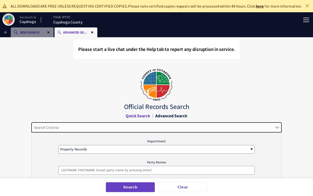
The form supports a document-focused check rather than a guess from a modern address alone. Preserve the document number and dates with the parcel notes.
Note: The county’s free Property Alert can monitor a filing name, entity, keyword, or existing document, but it does not guarantee notice or title accuracy.
Check Cleveland Street Permit Fields
The city adds a separate address layer through Accela Citizen Access. Cleveland says a person can look up permit status without a login. The interface offers general, address, contact, application, and parcel paths. A permit result documents reported city activity such as an application, permit, inspection, or status. It does not prove every alteration that took place at a structure.
| Accela address field | Format | Use in a Cleveland search |
|---|---|---|
| Direction | Dropdown | Use the directional prefix when the address has one. |
| Street No. | Text or range | Enter the known number or address range. |
| Street Name | Text | Use the street name without assuming a permit record is complete. |
| Street Type | Dropdown | Select the street suffix. |
| Unit Type / Unit-Suite | Dropdown and text | Narrow a multi-unit address. |
| City Parcel Number | Text | Use the city parcel key when it is known. |
| City / State / ZIP Code | Text or selector | Apply as geographic criteria, not proof of a municipal boundary. |
For an official code-violation letter, plan record, or a history that needs staff review, use the Department of Building & Housing’s written-request, telephone, or city-counter channels. Cleveland cautions that an address history is incomplete if required work was never reported to the city.
Cleveland Street Directory Records
A Cleveland street directory becomes more reliable when each source is assigned a narrow job. County property data supplies a parcel lead. Recorded documents supply dated parties and legal details. City records can document reported permit or code activity. Archives materials reveal earlier parcel context. None produces a complete list of residents along a road.
| Address-keyed source | Custodian | What it can establish | Access route |
|---|---|---|---|
| Current parcel record | Cuyahoga County Fiscal Officer | Parcel identity, property categories, transfers, tax and document paths | MyPlace, map, and Fiscal Officer channels |
| Recorded instrument index | Transfer & Recording | Parties, dates, document number, parcel, legal and address clues | Official Records Search and Recorder counter |
| Tax maps and historic mapping | Fiscal Officer Map Room / County Archives | Lot continuity, mapped context, historic ownership clues | MyPlace map, Map Room, and archive appointment |
| Historic tax records | Cuyahoga County Archives | Tax and value trail for 1819–1986 | Archive research route |
| City permit records | Cleveland Building & Housing | Address or parcel status and permit history | Permit portal, Accela, records office, or city kiosk |
| Probate estate record | Cuyahoga Probate Court | Estate or related court path tied to an ownership transition | Web docket, counter, mail, and copy forms |
The County Archives offers the fallback when a current display stops: deeds and ownership documentation about 1810 to present, original map volumes about 1860–1945, and tax records about 1819–1986. An appointment and a precise request work better than a broad request for a whole street.
The Fiscal Officer’s Transfer & Recording division also maintains property tax maps, processes plats, transfers and records instruments affecting real property, and creates new parcels. That mix explains why one address may acquire a different parcel relationship over time. A researcher should save the map clue and the document clue separately, then ask the appropriate county custodian for the underlying record when a parcel boundary, plat, or dated instrument needs confirmation.
Cleveland’s 1906 Street Conversion
Old address work has a specific Cleveland trap. Most street names and all address numbers changed under the city’s standardized plan in 1906. City Council adopted the numerical system on March 6, and it took effect December 1. Formerly annexed villages can add another numbering system. An older directory or map can therefore look empty when searched only with the present number.
The Cleveland Public Library’s property research guide identifies its Old and New Street Numbers reference work as the bridge. Record the current and former address, parcel number, legal description, subdivision or lot, dated map, and both sides of each deed before deciding that a historical address has disappeared.
A view of the city’s street-names history makes the conversion’s local importance clear.
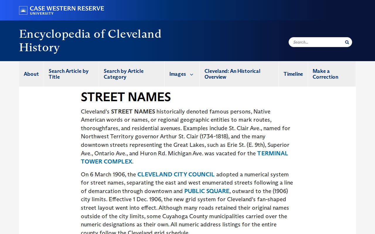
The historic source should guide a search for old forms, while the parcel and legal description keep the evidence tied to the same land.
Cleveland Street Map Context
Cleveland City Planning Maps add address search, parcel selection, zoning, landmark, ward, neighborhood, measurement, and print controls. They are useful for understanding the setting of a record and for comparing a historical label with current civic geography. Planning maps do not replace the Fiscal Officer as the ownership custodian.
The image below comes from Cleveland City Planning’s map material.
Use geographic layers as orientation, then return to the parcel record and recorded document for a source-specific answer.
Cleveland Street Records Use Many Maps
Cleveland street records do not share a single boundary system. A neighborhood label, ward, community development corporation service area, statistical planning area, municipal line, parcel boundary, and postal designation can all describe the same vicinity differently. City Planning groups Census tracts into 36 Statistical Planning Areas and six planning districts, so a neighborhood term is useful context but not a substitute for a parcel or legal description.
The city’s community-development GIS data is a useful reference for that distinction.
A record should retain the locality and geography printed by its own custodian rather than silently converting it into a newer neighborhood label.
Note: A city planning layer can clarify place, but the Fiscal Officer’s parcel and recorded-document records remain the stronger property evidence.
Cleveland Streets Need Known Names
Ohio Voter Search requires first name, last name, and county. It confirms registration and provides precinct or polling information, but it does not accept an address-only search. The official DATA Act voter archive is different: it offers daily county snapshots selected by date and county under Ohio’s Public Records Act, R.C. 149.43. A snapshot is dated material, not a live statement about an address.
Protected information remains protected. Ohio law excludes sensitive identifiers, confidential-voter material, protected addresses, and other barred data from the public registration record. Use a known-name confirmation for a lawful personal question, preserve the snapshot date when using an archival file, and send a correction or narrowly framed request to the Cuyahoga County Board of Elections.
Cleveland Street Directory Terms
Several terms appear repeatedly in an address trail. Keeping their meanings separate prevents a searcher from treating a postal, tax, and land description as if they were the same record.
- Parcel
- A county-tracked piece of land used to connect property data, maps, transfers, and tax records.
- Situs address
- The physical location of the parcel, distinct from an owner’s tax mailing address.
- Plat
- A recorded map or plan that can show a subdivision, lot, or other land arrangement.
- Criss-cross directory
- A historical directory section arranged by address, useful for a dated householder clue rather than a current roster.
For older work, pair a criss-cross entry with the edition date, former street number if applicable, map or tax evidence, and the county parcel identity.
Cleveland Street Directory Limits
Property filings name recorded parties and may show a tax correspondence address, but they do not identify every person in a household. The permit system records city-reported work and actions, not every physical change. Court records are case-specific. A missing result can mean the searched field, time period, street form, parcel identity, or custodian is wrong; it does not prove that nobody lives at the address.
Lawful use. Cleveland street and address records are for personal, lawful research. Do not use any result to stalk, harass, intimidate, or harm another person, and respect confidential-address protections.
For the best result, name the record type and date range when contacting a custodian. Ohio’s Public Records Act gives a written-request fallback for nonexempt government records, while exemptions and redactions still apply.